Parks, Trails & Open Space
This page is intended to provide basic information about Sebastopol park and recreation resources. The information includes: official City parks; other park and open space resources; and recreation facilities. It does not include school sites, most of which also provide recreation areas open to the public during non-school hours.
Blessed with natural beauty
Sebastopol is blessed with an array of park, open space and recreational resources, including those provided by local non-profits and a private development. Most of the facilities have identified issues or needs, some of which are quite substantial (complete renovation of Ives Park, replacement of the Community Center, replacement of the local library). A number of other needs, such as for restrooms at several sites, would also be expensive.
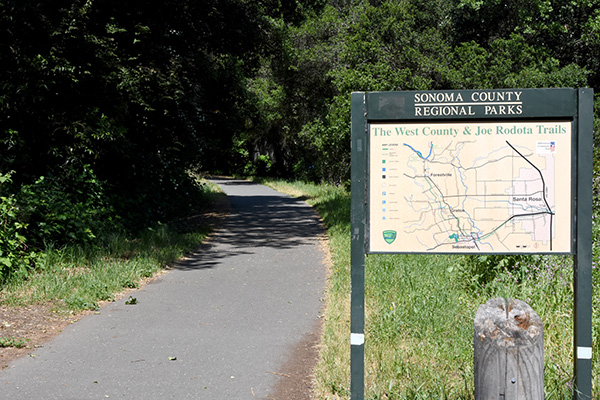
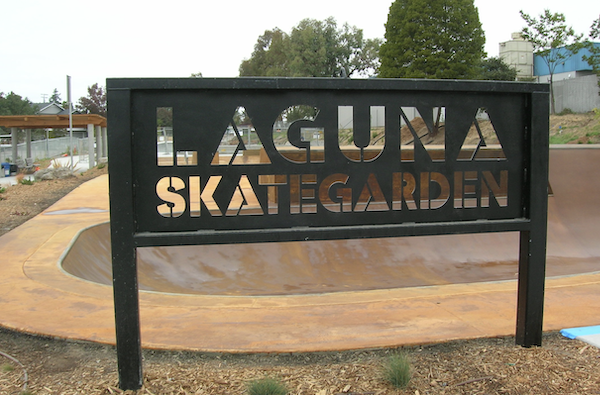
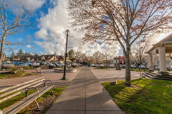
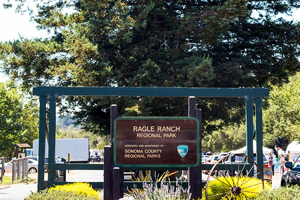
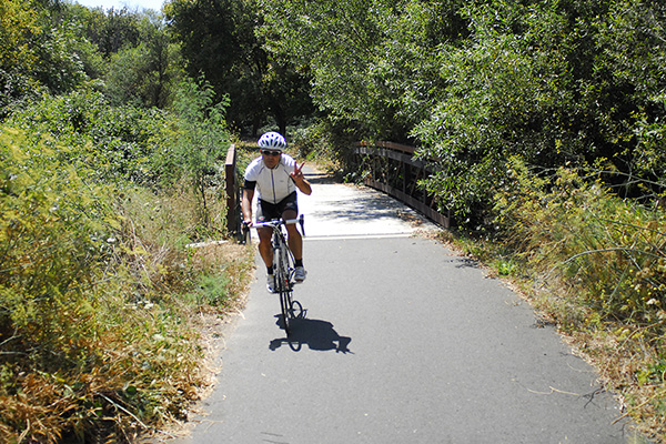
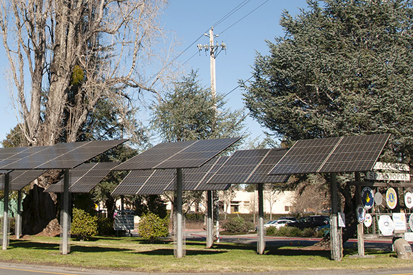
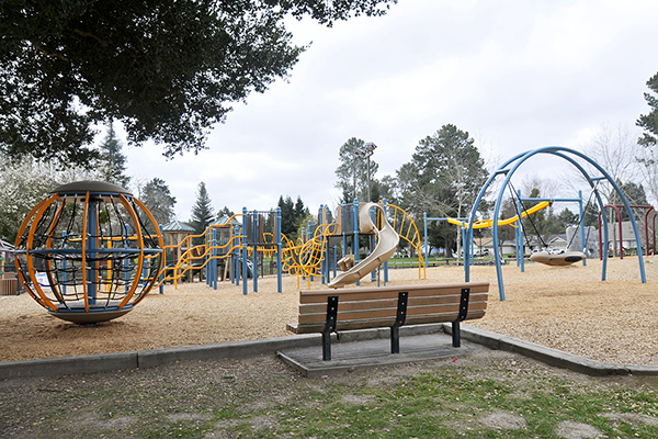
In the last 20 years, a number of significant new park and open space areas have been created, which is to the community’s credit. These include: the town Plaza; the Laguna Preserve; the Skategarden Park; the Laguna Uplands; the Railroad Forest bike path connector; Tomodachi Park; and the Barlow green. An expansion of Skategarden Park is pending. Most of these new park and open space areas have impacted the maintenance resources of the Public Works Department, which also assumed maintenance responsibilities for landscaping in numerous new ‘Street Smart Sebastopol’ pedestrian crossings.
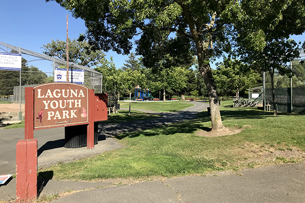
While there has been continuing community interest in creating new park resources, these new facilities have created substantial ongoing maintenance and improvement needs, in addition to needs at the City’s existing facilities such as Ives Park, Libby Park, the Youth Park, and recreational facilities such as Ives Pool and the Community Center.
Policy & Planning Docs
The Planning Department is also responsible for parks planning and grants, as well as planning and technical coordination for the Sonoma County Measure M “Parks for All” funding. The Department also manages the Community Garden Plots at the Skategarden Park. If you are interested in a plot, please contact ksvanstrom@cityofsebastopol.gov.
Current park planning projects include: Ives Park Master Plan Implementation, including Calder Creek naturalization, community sculpture garden, and pathway replacement; and the AmeriCorps Trail extension project.
Sonoma County Measure M Annual 2021/2022 Report Press Release

Ives Park & Pool
Ives Park
Ives Park is a community park, located at 7400 Willow Street. It was built over 65 years ago and is the oldest park in Sebastopol. It contains a municipal swimming pool, baseball field, playground, theatre stage, grassy fields, and picnic areas as well as a portion of Calder Creek. Ives Park is also home to several festivals: Cajun Festival, the Roma Festival, and the annual Sebastopol Apple Blossom Festival that draws approximately 25,000 people.
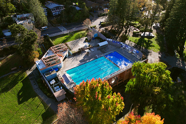
Ives Pool
Ives Pool is located within Ives Park on City- owned land at 7400 Willow Street.
It includes two pools: A six lane pool that measures 16 yards by 25 yards and a smaller pool that measures 16 yards by 14 yards. Ives Pool is used by both the Analy High School and El Molino High School swim teams and home to a wide variety of programs, serving a large number of users. Ives Pool is the only public pool in Sonoma County that is successfully operated by a non- profit organization. While substantially maintained by the pool non-profit organization, the City provides maintenance support for Ives Pool.
As an intensely utilized public pool facility, Ives Pool has substantial ongoing maintenance and capital improvement needs. Desired improvements include: expansion of the locker rooms; development of a family locker room/ bathroom; renovation of the picnic/ grounds area, possibly with water play fixtures. Fees, community and City support have enabled Ives Pool to continue its operations, but needs continue, and are significant.
Downloadable Documents:
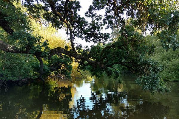
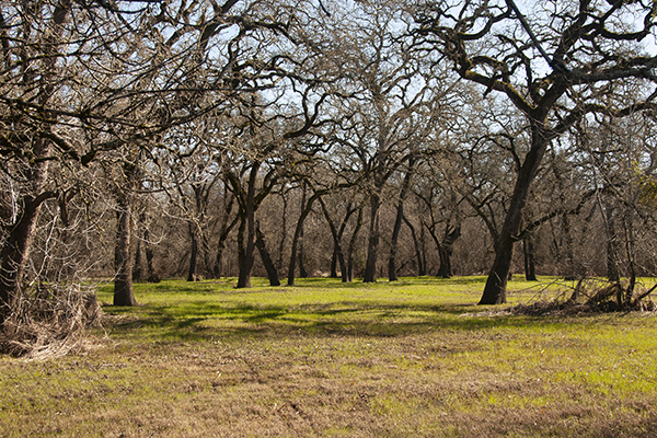
Laguna Wetlands Preserve
For information on volunteering , please contact the City Planning Department at (707) 823-6167. Volunteers have planted trees, shrubs and grasses, maintained trails, installed bird and bat houses, picked up trash and flood debris, and conducted educational tours for visitors. The Laguna Keepers is a special group of volunteers who regularly work to maintain and improve the Preserve. In addition, the Laguna de Santa Rosa Foundation also has a docent training program. Docents visit area schools to educate children about the value of the Laguna ecosystem.
The Laguna Preserve project also needs financial help. As a small city with very limited resources, obtaining community contributions and grants from outside agencies is critical to this project. Donations can be made to the City’s Laguna Preserve Fund, and should be sent c/o the City Planning Department, 7120 Bodega Avenue, Sebastopol, California 95472. Thank you!
You can also help by visiting the Laguna Preserve in Sebastopol and seeing for yourself this hidden resource. The Laguna is a premier bird-watching area, and you may be lucky enough to spot other wildlife. The scope of the Preserve so far is quite small, but over time, the hope is that it will grow substantially as the importance of this ecological resource is fully recognized. The entry to the Preserve is located at the south end of the Sebastopol Community Center Parking lot at 390 Morris Street in Sebastopol. There is a short walking trail that adjoins the Laguna channel, and loops around the City’s former wastewater ponds. From late Spring to early Fall, a floating pedestrian bridge is in place to connect to a trail on the east bank of the Laguna channel.
If you have questions, please contact the City of Sebastopol Planning Department at (707) 823-6167.
Summary Resource Information
The Laguna de Santa Rosa (or Laguna) is the second largest freshwater marsh in Northern California. It is called the “river that flows both ways.” During heavy rains, the Laguna flows south carrying floodwaters away from the Russian River, reducing its flood levels. After rains subside and the tides fall, the Laguna reverses its flow, returning the floodwater north, back into the Russian River and eventually to the Pacific Ocean. More water enters the Laguna from a collection of creeks, tributaries, springs, seeps and sub-surface flows. Because of this diverse water supply, the Laguna, through primarily a marsh, has characteristics of a stream, creek, seasonal wetland, open water, and other aquatic habitats in various locations.
The Laguna is a major retention basin, which is critical to reducing flood levels in the Russian River. The watershed encompasses 250 square miles and drains the southwestern part of Santa Rosa, the Cotati-Rohnert Park area, as well as the eastern side of Sebastopol. Flood waters flow from the Russian River into the Laguna whenever the flood stage in the river is higher than that in the Laguna, creating a temporary lake, The total flood storage capacity of the Laguna is 80,000 acre feet at the 76-foot elevation. By comparison, 130,000-acre feet are allocated to flood control at Lake Sonoma. Inundation of land along the Laguna may occur several times in a wet year (Elgar-Hill, November 1983).
When floodwaters rise above the 76-foot level, the storage capacity exceeds that of Lakes Mendocino and Sonoma combined. Without this natural flood storage area, the 100-year flood level at Guerneville would be 14 feet higher, effectively submerging most of the town’s structures. Any decrease in the storage capacity means a corresponding increase in flood levels. Some increased fill in the Laguna must be expected from natural and man-induced causes, a fact which should be considered when evaluating controllable filling of the basin.
Some of the earliest records of the natural environment of the Laguna area came from the first decade after the discovery of gold. Frank Marryat, a writer and explorer, kept a journal of his exploits from 1850-1851 in the North Bay area and his visits to San Francisco in Gold Rush days (Marryat 1977). Bayard Taylor, a poet and lecturer, described the beauty of natural features in the Santa Rosa Plain during an 1859 ride to the Geysers, in New Pictures from California (Taylor 1951).
Marryat’s first impression of the Santa Rosa valley is captured in the following comments:
Leaving (town of) Sonoma . . .. studded with groups of oaks and flowering evergreens. . .. herds of deer . . .. and here and there a drove of elk or antelope. (Page 12)
[M]arsh full of wildfowl. . .. wooded plain with grasses as tall as ourselves abounded with deer, elk, and antelope. . .. shot all the came in our way . . ..native horses. . .. much wild duck. . .. (Page 14)
Included in this scene were grizzly bears, which fed on the silver salmon and steelhead migrating to spawning gravels throughout the Mark West Creek, Santa Rosa Creek, and Laguna de Santa Rosa watersheds.
One of the most dominant aspects of the early Laguna environment was oak woodland vegetation. Marryat, from a high spot on the west side of the valley, reported a “thickly wooded plain extended for miles” – on one side bounded by mountains, on the other . . .. the winding Russian River.” (Page 22)
On a trip through the valley on the way to the Geysers in 1859, Bayard Taylor wrote of the oaks:
As we got out of the shabby little village of Santa Rosa, I perceived we were already in the Russian River Valley. Its glorious alluvial level, sprinkled with groves of noble trees, extended far and wide before us. . .. The greater part of the land was evidently claimed and the series of fenced and cultivated fields on either side of the road was almost uninterrupted. It was melancholy to see how wantonly the most beautiful trees in the world had been destroyed; for the world has never seen oaks as grown in the Russian River Valley. The fields of girdled and blackened skeletons seemed doubly hideous by contrast with the glory of the surviving trees. (Page 28).
From these accounts, it is clear that the Santa Rosa Plain and Laguna were much different than today. More trees and marsh were present; waterfowl and wildlife abounded.
Natural Functions Provided by the Historic Laguna Ecosystem
The original natural plant and animal communities in the study area functioned as integrated units in the larger ecosystem, roughly defined by watershed boundaries. Matter and energy originated from the peaks and slopes of the upper watershed beyond the study area, flowed through the Laguna ecosystem and accumulated in the Laguna floodplain. There, the vast, swampy riparian forests and freshwater marshes removed or transformed them into organic form, acting to improve downstream water quality by reducing the quantity of nutrients available for algal blooms (Mitsch and Gosselink 1986). Organic matter produced by riparian and marsh plants was a key source of energy for detritus and filter-feeding organisms at the base of the food chain leading to native fishes of the Russian River and Laguna system.
The freshwater marshes of the Laguna functioned similarly to those of the riparian forest wetlands. The marshes functioned as a nutrient sink; transforming inorganic nutrients brought in from the watershed into organic compounds, which were flushed into downstream riverine ecosystems during high flows. This organic export was utilized as an important supplement to the base of the food chain in the Russian River. Other nutrients became bound in sediment of the marsh and were removed from short-term cycling in the ecosystem.
Freshwater marshes are among the most heavily producing ecosystems in the world. The increased food availability served as a resource when the surrounding oak woodland was senescent during the summer. The number and variety of niches may have been less than the riparian forest, so diversity of species was less. However, freshwater marshes provide essential habitat elements for waterfowl and shorebirds, which do not frequent riparian wetlands. This perennial freshwater marsh represented the most limited habitat in the study area. Relatively small acreage of open water bodies interspersed with marsh vegetation was very attractive for waterfowl. Without the freshwater marshes, the waterfowl component of the Laguna area would have been greatly diminished.
The oak woodland/vernal pool complex surrounding the wetlands of the Laguna ecosystem provided an extensive seasonal resource dominated by availability of acorns and grasses. These food elements allowed large populations of herbivores to exist on the Santa Rosa Plain. The grasses provided winter, spring and early summer forage for the antelope, elk, and deer herds. Acorns supplemented this feed and also sustained bears and a number of small mammals such as gray squirrels and ground squirrels, which in turn were prey for eagles, hawks, coyote, fox, badgers and bears. The grain resource supported rodents and rabbits, which also served as prey. The large herbivores were likely preyed upon by cougar, grizzly bear and wolves. Turkey vultures joined the carnivores to feed on carrion.
These woodlands would come into productivity earlier in the spring because soils warmed sooner and were not saturated as long as those of the wetlands. The deeper porous soils would absorb rainwater and release it slowly to surface water of the streams. The vernal pools acted as a buffer to heavy rains, storing water that otherwise would have run off directly into the Laguna and increased its flood-peak. These pools also acted as seasonal wetlands, prolonging the usefulness of the dryer grasslands by supplying water and growing forage. Migratory waterfowl utilized the aquatic food resource of the pools, with resident mallards nesting in adjacent grasslands. Mallards, pintails, wood ducks, and other birds would feed on the abundant acorn crops, as would deer, elk, bears, raccoons, rodents and other mammals.
Changes to Laguna Ecology
By 1859, permanent changes to the landscape of the Laguna area had been affected by the coming of Europeans and the resulting agricultural conversion; but man had already altered the vegetation before the arrival of any whites in the area.
Use of Fire
Vegetation and habitats of the Laguna ecosystem had been subject to a millennia of disturbance at the hands of the indigenous Native Americans. The following account indicates the local Pomo Indians had a large effect on the landscape through the practice of burning:
The rainy season was approaching and the heat became occasionally intense. At times, the Indians would fire the surrounding plains, the long oat-straw of which would ignite for miles. The flames would advance with great rapidity, leaving everything behind them black and charred. . . The Digger Indians burn the grass to enable them to get at roots and wasp nests; the young wasps being a luxury with them (Marryat 1977; page 36)
The effect of this practice would be to suppress the establishment of woody plants, except those, like oaks, can regenerate from a tap root. Even so, fires would remove the weaker trees and hinder establishment so that the woodland remained relatively open and park-like. Despite this inhibitory effect, the plains would appear much more like a woodland than the scattered trees, which make up our savanna today.
Hunting of Wildlife and Waterfowl for Sustenance and Commerce
Much of the food supply for residents and visitors to the Laguna area came from the hunt, which apparently was accomplished with ease:
The wild fowl came over in heavy flight and settled in our vicinity. The geese were in incredible numbers; white and grey geese and brandts. Of ducks we had several varieties, and I regret that I failed, from want of materials, in my endeavors to preserve specimens of them. The geese are very easily shot when they arrive, soon become very wary (Marryat 1977; page 33)
Before long, commercial hunters appeared on the scene to supply the hungry citizens of Gold Rush San Francisco. One market hunter bagged 6,200 ducks in 1892 (LeBaron 1987). As reported by Dodds (1976):
Deer and antelope brought twenty dollars each delivered to the waiting boats on the headwaters of Petaluma Creek. The hind quarters of a fat elk was worth $40, and even quail sold for $9 a dozen. Ducks were worth a dollar each and bear meat jerked or fresh was a staple in the gold rush diet. Some elk and grizzlies could be found far back in the hills of the county until the 1870’s, but the valley populations were quickly exterminated.
The combined effect of the market hunters had decimated waterfowl to such a degree by 1897 that a local gun club prevailed on the Board of Supervisors to outlaw commercial hunting (LeBaron 1987). But by this time, the composition of the Laguna ecosystem had changed and the diversity of species had diminished greatly.
Introduction of Cattle and Loss of the Native Prairie
A drastic change to the vegetation of the Santa Rosa Plan was the conversion of the native grassland vegetation after cattle were introduced on the scene. Although feral horses and cattle had probably invaded Sonoma County in the late 1700’s, soon after the Spanish colonization of California, the impact on grasslands became significant after General Vallejo granted essentially all of the Santa Rosa Plain to the Carrillo family in 1837 (LeBaron 1987). The family controlled all the land from Rincon Valley on the east to Laguna de Santa Rosa on the west. Making up the remainder of the Santa Rosa Plain were Rancho San Miguel to the north and Cotate Rancho to the south.
The lifestyle practiced by these early settlers varied greatly form that of the Native Americans, who were often coerced to work on the ranches. The pastoral life of the Californios, remembered as giving early California much of its romantic charm, introduced a use of the land centered on a cattle export industry. Longhorn cattle were raised primarily for hides and tallow, which were shipped to Mexico. Although this practice (in which the bulk of the animal was discarded) benefited the carrion-feeding wildlife, the native grasses were reduced by grazing. The original Santa Rosa Plain grassland was dominated by a mix of perennial bunchgrasses and annual forbs. The longhorns, and later varieties of cattle, quickly destroyed the forage base of native grasses, which were not adapted to such heavy use (Heady 1988; Bartolome 1987). In their place, new plants, survivors of thousands of years of livestock use in a climate similar to California’s arrived from the Mediterranean.
Deforestation of the Oak Woodland
At one time, much of the Santa Rosa Plain was covered by a mantle of oak woodland, varying in density from forests to open savanna. Settlers looked upon the trees as a resource to be exploited, or a problem to be removed. Many trees were girdled, a practice in which all the living tissue (i.e., the outer layers) of a tree trunk was removed in a ring around the trunk, to make way for wheat fields (Taylor, 1951). Taylor attributed the practice to people known as “Pikes”, a term referring to settlers from Missouri, Arkansas and adjacent areas. He sums up the Pike attitude to trees as follows:
[H]e has an implacable dislike to trees. Girdling in his favorite mode of exterminating them; but he sometimes contents himself with cutting off the largest and handsomest limbs. When he spares one for, the sake of a little shade near his house, he whitewashes the trunk. (Page 13).
Commercial harvesting also diminished the extent of oak woodland on the Santa Rosa Plain. Evidence of the extent of this harvest can be seen in typical railroad shipment data from the little village of Fulton in 1878:
- 9000 cords firewood
- 1000 cords tanbark (oak used in tanning leather)
- 150 railroad carloads of charcoal. (Dodds 1976)
At times the valley must have been under a pall of smoke from charcoal production. Another secondary impact of this denudation was increased erosion of hillsides. The sediment loads would foul spawning grounds and accelerate sedimentation of the Laguna lowlands. Evidence of accelerated sedimentation continues to the present, with recent fences subject to burying during peak runoff events. The increase in flooding led to pressure on local officials and landowners to begin flood control and channelization projects, which further exacerbated the loss of important wildlife habitats.
This history of deforestation since the days preceding the arrival of European man follows a pattern described by Soule (1986) for Mediterranean climates world-wide, in which deforestation leads to the development of savannas and eventually deserts. This final desert state in the Laguna area has been avoided because of the availability of water for irrigated pasture and crops.
Cultivation
In 1851, Marryat returned to Santa Rosa after a winter’s sojourn in the Russian River and found the Carrillo family departed in the wake of Yankee progress and its accelerated capitalist economy. The days of the vaquero and the Californios were over. Instead, in 1853, Jacob Miller brought out most of the Carrillo family’s Rancho Cabeza de Santa Rosa and subdivided it among ambitious wheat farmers. The rest of the ranchos soon followed the same fate, and grain carpeted large acreages of the Santa Rosa Plain. Many tons of wheat were shipped from Petaluma at this time (LeBaron 1987). In 1915, most of the production of wheat and oak grains was from the Dublin clay adobe (Clear Lake clay) in the area referred to as the “Cotati Valley” (Watson et al. 1917). This use of the land converted what was once a vast seasonal and perennial wetland complex into intensely managed cropland (described further in the section on drainage, below). By this time, the production of grain was used mostly for hay, and was exported because volumes exceed local need; a situation reversed today.
Former areas of grain crops on better soils were converted to higher cash crops such as fruit trees (especially prunes, plums, pears and peaches), wine grapes, and some walnuts and hops in alluvial areas of the major drainages.
Channelization of Creeks and Wetlands
Grains were planted in much of the Cotati valley, as the more productive soils went to other agricultural uses. These soils developed under marshy conditions (Helley et al. 1979), and were considered the most marginal soils for cultivation in the Santa Rosa Plain area. An 1867 map, the earliest known map of the Laguna, shows the creeks tributary of the upper Laguna disappearing without defined channels into the wetlands of the Cotate Rancho. By 1877, the area had been traversed by the San Francisco and Northwestern Pacific Railroad and two of the major creeks draining the west slope of Sonoma Mountain, Copeland Creek and Crane Creek, showed defined channels crossing the Cotati Valley and connecting directly with the Laguna de Santa Rosa on the western side of the valley. By 1915 these channels had been further straightened. The construction of the railroad likely prompted the need to drain the east side of the tracks, in order to prevent the creation of a miles-long dam restricting outflow from the Sonoma Mountain. This effort worked in tandem with the local desire to increase productive use of the land, thereby draining a large acreage of what was once a vast seasonal and perennial wetland.
In 1915 these wetlands conservatively totaled approximately 1,400 acres. Technically, only the wettest, most saturated areas were depicted on these maps; seasonal wetlands were probably not considered. A comparison with the latest USGS map of the Sebastopol quadrangle (USGS 1980 shows a much reduced area of the map symbol for swamps and marshes present; an indication of changes which have occurred to Laguna wetlands with the passage of time.
In 1945, a USFWS biologist surveyed the Laguna (McBride 1945, in Cardwell 1958), and reported that “at times, the Laguna area is one continuous body of water as much as 10 miles in length and ranging in width from a few hundred feet to as much as 1.5 miles locally”. He goes on to state that “[e}vapotranspiration occurs on a large scale along the Laguna de Santa Rosa at the western side of Santa Rosa Valley in a swampy area that varies in size with seasonal rainfall conditions but averages about 1,000 acres during the summer.” Study of 1941 aerial photographs in the local Soil Conservation Service office in Santa Rosa reveals that at least 500 acres of riparian forest (i.e., forest which occurs along a waterway’s edge and separates it from surrounding marshlands) had been cleared before McBride’s survey (Waland 1989), by local farmers wishing to increase cultivated acreage along the boundaries of the Laguna floodplain. Evidence of accumulated woody debris and buried charcoal at shallow depths is widespread in the Laguna today, including areas in which the cleared forest has reappeared (Waaland, unpublished field data). Only 272 acres of this riparian forest exist today (Waaland 1989).
Most of the recent clearance of the Laguna channel was a direct result of a channelization project undertaken in 1966, which the SCWA implemented for agricultural drainage purposes (SCWA 1960). The SCWA undertook the project at the urging of local farmers (de Mars et al. 1977). Eight miles of pilot channel with a 100-foot right-of-way was excavated from Occidental Road to one mile north of Guerneville Road. From this point to River Road, the Laguna was channelized as a result of the efforts of local farmers.
Need for Restoration
Past agricultural and urban development have adversely affected the Laguna. Riparian forests and oak woodlands have been cleared, past flood control practices have negatively affected the Laguna, and waste disposal practices have affected water quality. Even though a significant portion of the Laguna habitats have been lost or degraded, much remains. The remnant habitat must be protected against further loss, and restoration must occur to damaged habitat.
According to the March 1997 Russian River Action Plan published by the Sonoma County Water Agency, there is a need for “…preservation, restoration, and enhancement of riparian, oak/vernal pool/grassland, and historic wetland habitat in the Laguna de Santa Rosa area.” These efforts will “…improve water quality, improve integrated flood plain management, maintain and enhance native habitat values, assist recovery of plant and animal species, enhance scenic values and coordinate resource management.” (Russian River Action Plan, page 18).
Recent Restoration and Protection Efforts
Citizen efforts to protect and restore the Laguna began in the 1970’s, including in the City of Sebastopol. Lands of the Laguna directly adjoin the City of Sebastopol. In 1986, the City of Sebastopol appointed a broad-based citizens advisory committee regarding the Laguna. This committee produced a comprehensive report in 1988. Continuing these efforts, in 1990, the City initiated the development of a master plan for restoration of the Laguna in the vicinity of Sebastopol. The Laguna de Santa Rosa Master Plan was adopted by the City Council in 1992.
In 1998, the City Council funded preparation of a Laguna de Santa Rosa Wetlands Preserve Implementation Plan for City-owned land. These plans will be the basis for actual construction of improvements and restoration projects in Sebastopol. Using a $400,000 donation from Emmett Blincoe, a local resident, and contributions from other members of the community, and in a cooperative effort with the Laguna de Santa Rosa Foundation, the City started construction of the first elements of the Preserve in November 1998, and completed these improvements in January 1999, using plans prepared for the Implementation Plan. The City successfully obtained restoration grants from the State Wildlife Conservation Board, and the Sonoma County Fish and Wildlife Advisory Board. In addition, through sponsorship of Assembly Member Virginia Strom-Martin, the City obtained a $95,000 grant from the State of California for construction of an outdoor classroom for environmental education. The fourth place of implementation involved the City’s successful application for a $258,300 Coastal Conservancy grant for a loop trail, restoration, a trail guide, and a wonderful interpretive poster. Contributions to this phase were also made by the Barlow Company.
In 2003, a major turnout of Americorps volunteers and Laguna Keepers resulted in the completion of a new “primitive” trail segment, the “Americorps Trail.”
Volunteers as well as workers from Americorps and the California Conservation Corps have conducted a number of Laguna cleanup and non-native plant removal events, which also performed an important educational function. Using volunteers from the community, over 1000 native trees and shrubs were planted for this project in Fall 1998. More work was accomplished in 1999, including additional trails, a wetland enhancement project, development of a seasonal floating trail bridge, and an outdoor classroom as well as planting of hundreds of additional trees, shrubs, and grasses.
The City of Sebastopol’s Laguna Wetland Preserve is the only publicly designated natural park in the Laguna. While there are scattered restoration efforts and projects by other entities such as the State Department of Fish and Game, the City of Santa Rosa, and the Laguna de Santa Rosa Foundation, the City of Sebastopol’s Wetland Preserve is the only area specifically designed for public access and passive recreation and educational uses.
The City expects its modest beginning to act as a lightning rod for efforts in the entire watershed to restore, protect, and provide public access.
The Laguna Preserve is expected to be of particular utility for area schools. In addition, the Laguna Preserve is expected to attract visitors from throughout Northern California and beyond. The Laguna is one of the premier bird-watching areas in Northern California. By providing public access to the Laguna and education about it, this project will facilitate access to persons within and well beyond Sonoma County. In addition, the improvements are designed to be accessible to the elderly, the disabled, and with no cost of admission, the economically disadvantaged.
For More Information
Copies of the City of Sebastopol’s Laguna de Santa Rosa Park Master Plan (two volumes) are available at the Sebastopol Planning Department, 7120 Bodega Avenue, Sebastopol, and are also on reserve at the Sebastopol Regional Library at 7140 Bodega Avenue in Sebastopol. The Master Plan has extensive information about the Laguna, as well as setting forth broad plans and policies for that portion of the Laguna adjacent to Sebastopol.